
Finding Ithaca Streets by Address
Address research in Ithaca starts with the physical location, also called the situs. The Tompkins County Department of Assessment lists current property information through its Beacon landing page and publishes annual assessment rolls. Those sources can connect a street number to a tax-map parcel, an owner name, a mailing address, assessments, exemptions, and a deed book or page reference when the roll shows one. The owner mailing address is not proof that the owner lives at the parcel. It is the address used for tax notices and may be elsewhere.
Use a street-by-street sequence that preserves the parcel number and municipality at each stop. A directory entry, deed, or map can then be checked against the same property rather than treated as a standalone name match.
- Enter the current address at the Tompkins assessment database and record the situs, parcel number, owner field, mailing address, and any deed reference.
- Open Mapping Tompkins with the address or Printkey. Confirm the parcel geometry, street frontage, and municipality.
- Use the owner name, document number, subdivision, or recorded-date range in the County Clerk index. Search the recorded legal description when a present-day number is absent.
- Read the Ithaca street-and-house section for the relevant historical year. Scan both sides of the street and nearby numbers because older city labels and numbering can differ.
- Treat permits and tax rolls as dated property evidence. Use recorded deeds for the legal title trail, not a mailing address or directory listing.
Note: An assessment owner is a property-record field and does not confirm who currently occupies an Ithaca address.
Ithaca Address Records Fields
The published 2025 City of Ithaca final assessment roll shows why an address needs more than one field. Its entries include a tax-map parcel number, property location and class, assessment, exemptions, county, city and school values, current owner, owner address, school district, land, taxable value, parcel-size or grid information, special districts, account number, deed book and page, and full market value. The roll identifies its municipality and SWIS code as well. These fields make the record useful for matching a location to a county index.
One visible example separates a Heights Court property location from a West King Road owner mailing address. That difference is normal for tax administration. Keep both values, label them clearly, and avoid turning either one into an unsupported claim about who occupies the property.
- Parcel or Printkey
- A tax-map identifier that links mapping and assessment records, even when a street number changes.
- Situs address
- The physical property location used in assessment and GIS records.
- Mailing address
- The address used for tax notices. It can differ from the situs and may name an agent or entity.
- Legal description
- The deed’s lot, subdivision, metes-and-bounds, or prior-instrument description. It is often stronger than a modern street number for older records.
Ithaca Street Directory Mapping
Tompkins GIS maintains countywide address data, parcel layers, public-safety mapping support, map applications, and open-data services. Its documented tools include a simple parcel viewer that accepts an address or Parcel ID/Printkey, a fuller parcel viewer, elections address lookup, a school-district map, and several public layers. That makes GIS the geographic check in an Ithaca street directory search. It can show where a parcel sits on a block and which municipal boundary applies.
Tompkins County Land Services explains the county office that keeps the recorded land trail.
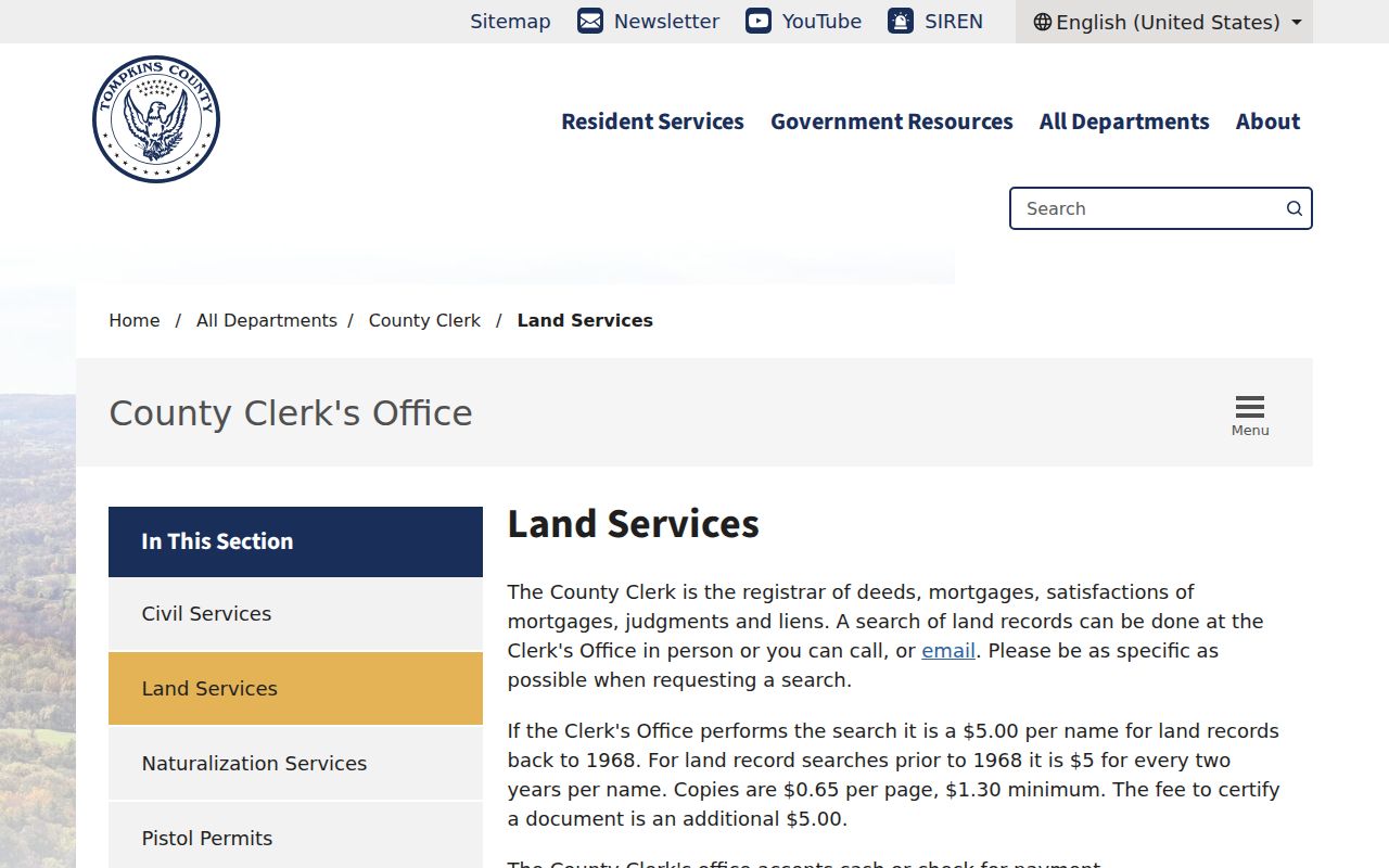
Use the land-services route after the map supplies a parcel or owner clue. County mapping products are compiled from deeds, surveys, digital base maps, and older mylars, and the county warns that a map cannot replace a deed or survey.
For an address close to the city edge, record City of Ithaca or Town of Ithaca separately from the postal city. A postal address can say Ithaca while the applicable assessment roll, permit custodian, or tax office is not the City of Ithaca.
Ithaca Street Directory Evidence
Several records can be keyed to an Ithaca address, but they answer different questions. The assessment roll and GIS give the parcel frame. The Clerk’s index gives recorded parties and instruments. Historical street sections can place a household or business at an address for a published year. City permit applications may provide a date-stamped property clue, although the official city pages did not expose a public issued-permit result index.
| Address record | Tompkins keeper | Useful street detail | Access route |
|---|---|---|---|
| Assessment roll | Department of Assessment | Parcel, situs, owner and mailing snapshot | Beacon, roll PDFs, or Assessment office |
| GIS parcel layer | County GIS | Parcel geometry, address and Printkey | Mapping Tompkins or GIS office |
| Land-record index | County Clerk Land Services | Parties, date, document and legal-description clues | PublicSearch, staff search, or counter |
| City permit record | City of Ithaca | Application or inspection location and dated work clue | Permit Wizard or City FOIL request |
| Street and house directory | History Center and TCPL | Published household or business address snapshot | Library or archive collection |
None of these is a complete household list. A recorded owner may be an LLC, trust, estate, church, university, or condominium entity. A directory is also a compilation from its own year, not a title record or proof of continuous occupancy.
Ithaca Street Deed Searches
The Tompkins County PublicSearch portal is the official index route for deeds, mortgages, satisfactions, judgments, and liens. Its January 2026 platform provides Quick Search and Advanced Search. A search term may be a grantor or grantee, subdivision, document type, or document number. When a street address does not appear as expected, search the distinctive owner surname and a recorded-date range, then inspect the legal description in the instrument.
| PublicSearch control | Documented use |
|---|---|
| Search Term | Grantor/grantee, subdivision, document type, or document number. Add * after a partial name. |
| Recorded Date | Start and end controls, plus presets from the last 24 hours through one year. |
| Search scope | Index Only searches indexed information. Index and Full Text OCR searches document contents. |
| Multiple words | Index-only treats the words individually; OCR treats them as a phrase. |
| Modes | Quick Search and Advanced Search, with Search and Reset Search controls. |
The captured interface did not establish result limits, image prices, export behavior, login requirements, or the full document-type list. When online work stops, Clerk staff accept specific requests in person, by telephone, or by email. The published charge is $5 per name back to 1968 and $5 per two-year period per name before 1968, with copies at $0.65 per page, $1.30 minimum, and $5 for certification.
A focused request is more likely to reach the right instrument. Include the parcel or deed reference, present and historic street forms, approximate recorded date, and every known party. The Clerk’s genealogy material also distinguishes its local 1817 land-record statement from another county page that says 1819 to present. Preserve that discrepancy in research notes instead of silently choosing a broader online cutoff.
Note: Tie Clerk staff-fee estimates to the date range and number of names because broad historical requests have separate charges.
Ithaca Street Names Across Time
Historic names are part of the address key. Factory Street became Stewart Avenue when Ithaca became a city in 1888, so both names belong in a deed or directory search. On South Hill, Creek Road is today’s Giles Street and the Owego Turnpike is today’s Hudson Street. Waterfront descriptions can use Steamboat Landing or Cayuga Inlet language that does not align neatly with present geometry.
Start the historical portion with the precise directory year and its street-and-house section. The History Center’s Ithaca directory collection spans 1864 through 1989, while digitization permission covers H.A. Manning volumes from 1923 through 1986. The Ithaca city directories are the better route for collection detail; along a street, record initials, businesses, and each listed number before comparing an adjacent year.
Note: No official citywide street-renumbering schedule was located, so do not assume a changed number reflects one systemwide event.
Ithaca Street Records in Motion
Permit records can add dates to an address trail. The City of Ithaca provides a current Permit Wizard and online permit categories, while older or issued-history material may require a request through the City’s FOIL process. A permit can identify an application or inspection location and may name an applicant, contractor, or owner-agent. It is dated building evidence, not a complete roster of everyone connected to a street.
For recorded-document monitoring, the County Clerk announced its new PublicSearch platform and free Property Fraud Alert on January 20, 2026. A person may register multiple names or properties for email or phone alerts. The Clerk records documents as presented and cannot verify legitimacy, so an alert is an early warning rather than a title opinion.
Ithaca Street Directory Jurisdictions
An Ithaca mailing address does not settle which government keeps an address record. The City of Ithaca is surrounded by the separate Town of Ithaca, and Cornell campus has its own postal pattern. Assessment rolls are municipality-specific. City permits and code records belong to the City’s jurisdiction, while town channels handle their own records. Before asking for a permit, tax item, or historical map, use the parcel viewer to identify the municipality and retain that result alongside the street address.
Postal ZIP codes are routing geography, not a city-limit test. USPS lists 14850 as the primary general Ithaca postal ZIP and identifies 14851, 14852, and the Cornell-oriented 14853 in Ithaca routing materials. An exact USPS address lookup can standardize the delivery ZIP, but the same address should still be checked in county GIS or Assessment for its parcel and municipality. An Ithaca postal label can cover a Town address or an institutional address.
The address record also has several keys that should not be merged: a situs identifies the physical property, a mailing address directs tax notices, a tax-map parcel anchors mapping, and a deed legal description identifies the recorded land interest. The postal ZIP is a separate routing key. Keeping those fields apart avoids attaching the wrong custodian or prior document to a street search.
County GIS began converting paper tax-map archives into a multilayer GIS dataset in the mid-1990s. The current map layers are practical for locating a parcel, but the county’s legal warning still applies to every period of the street trail: maps are compiled from several source types and can contain omissions or errors. When an old boundary, frontage, or lot line matters, request the deed or survey that supports it. For custom mapping or analysis, county planning material directs requests to GIS staff rather than treating the public viewer as the final record.
Ithaca Street Record Limits
An Ithaca street directory can help identify parcels, recorded owners, legal transfers, and historical address snapshots. It cannot turn a map or tax roll into a reliable list of current occupants. The county’s voter lookup is an individual registered-voter and poll-site tool, not a street browse. Election Law restricts use of individual voter registration information to elections purposes, and a Board of Elections request is not a casual address-list channel.
Use the City or Town custodian that matches the parcel, and ask a records office for the exact series needed. The County Clerk’s land records begin locally in 1817, but digitization and indexing are not the same thing. An unsuccessful portal search can mean that the relevant year, image set, historic name, or jurisdiction needs a different access channel.
Lawful use. Use Ithaca address records for personal, family, property-history, or civic research. Do not use information from an address search to stalk, harass, intimidate, or harm anyone.